SPACE PROJECTS
Current research projects at Aarhus University with elements relevant for using remote sensing
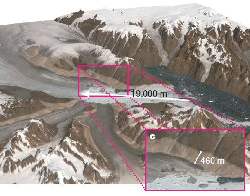
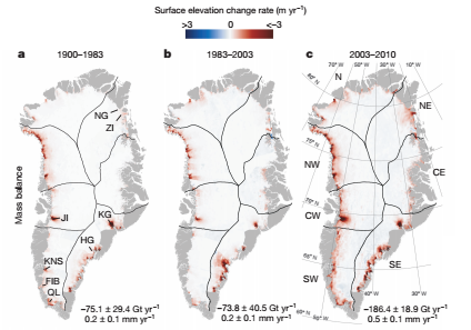
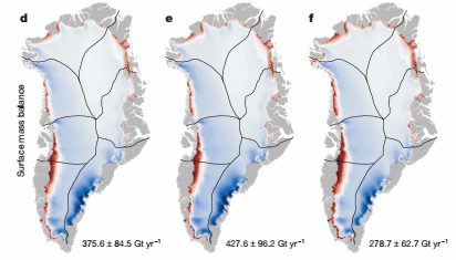
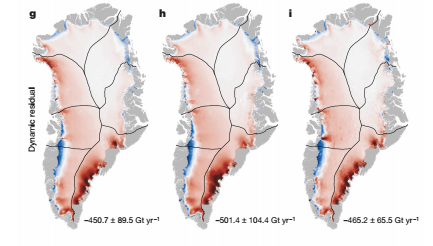
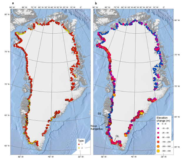
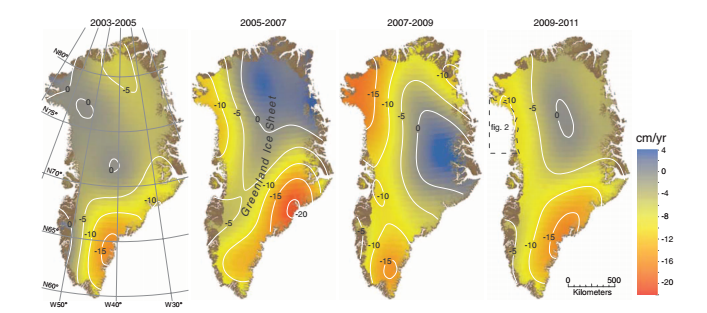
Utilizing remote sensing technology for monitoring the cryosphere in Greenland.By utilizing existing satellite technology such as the ESA Cryosat and the NASA MODIS program, we are using satellite produced imagery and aerial photography to determine the effect of global warming on the cryosphere in Greenland. Using SAR technology and GRACE observations to generate monthly ice volume estimates, we can monitor the cryosphere's rate changes
|
|
|
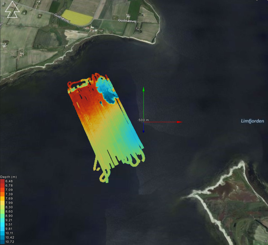
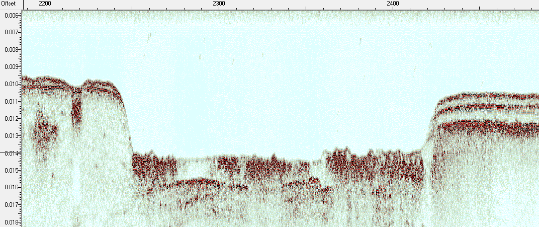
Understanding shallow marine and coastal regions by combining remote sensing technology and reflection seismic dataBy using optical imagery, LiDAR, submersible drones and hull-mounted instruments on research vessels, we can investigate geomorphological features of coastal and shallow marine areas in order to gain insight into currently ongoing coastal processes. By combing the surface and seafloor data with subsurface data in the form of high-resolution reflection seismic data, we can begin to understand the link between the surface and the subsurface and the geology and geological processes herein. Such information can be used for paleolandscape and paleoenvironment analyses, which may aid in locating resources or understanding the dynamic coastal behavior as it is affected by climate change.
|
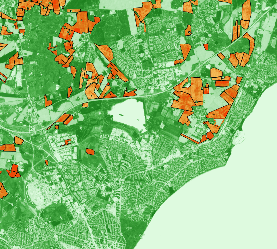
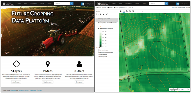
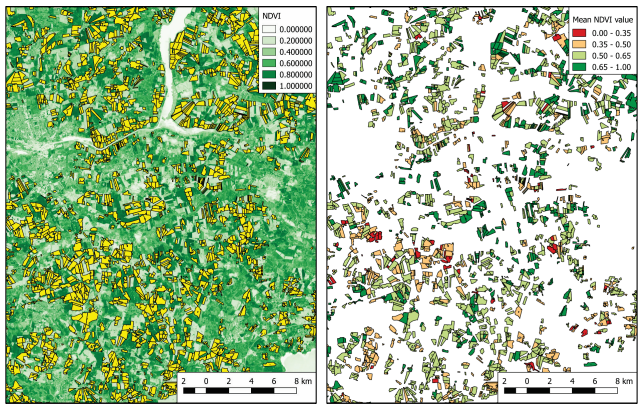
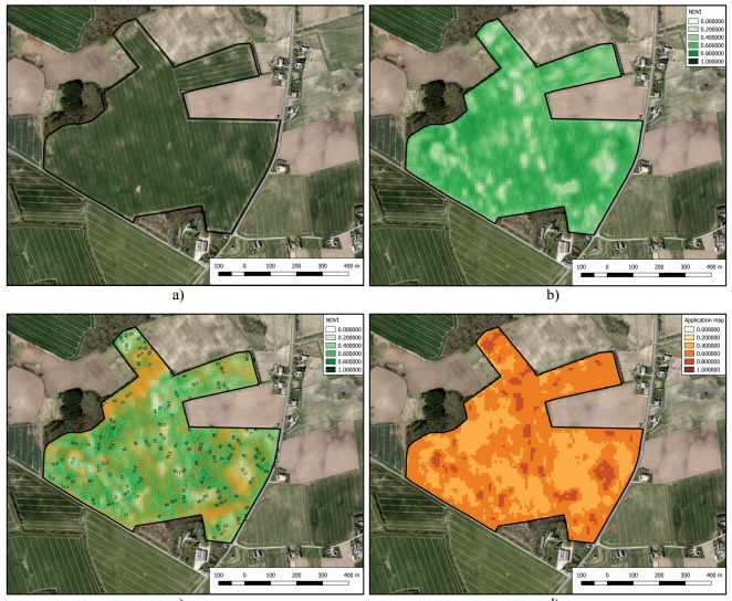
Applying remote sensing data for increasing agricultural efficiencyWe are investigating the potential application of satellite remote sensing technology such as synthetic aperture radar (SAR) and optical imagery for agricultural sciences. By managing and analysing the vast amount of data provided by open data sources such as the ESA Sentinel program and the Danish Agrifish Agency, we are able to make qualified estimates on parameters such as biomass, water run-off, nutritional wash-out and the effect of surface elevation. This utilisation of remote sensing technology can aid the agricultural sector in boosting the crop yield through a pinpoint analysis of individual crop fields
|
|
|
David Lundbek Egholm
Professor w/ special responsibilities Email: [email protected] Address: Høegh-Guldbergs Gade 2, 8000 Aarhus C. |
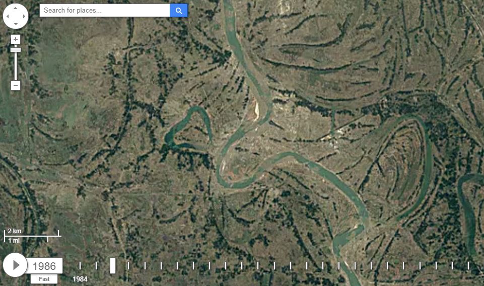
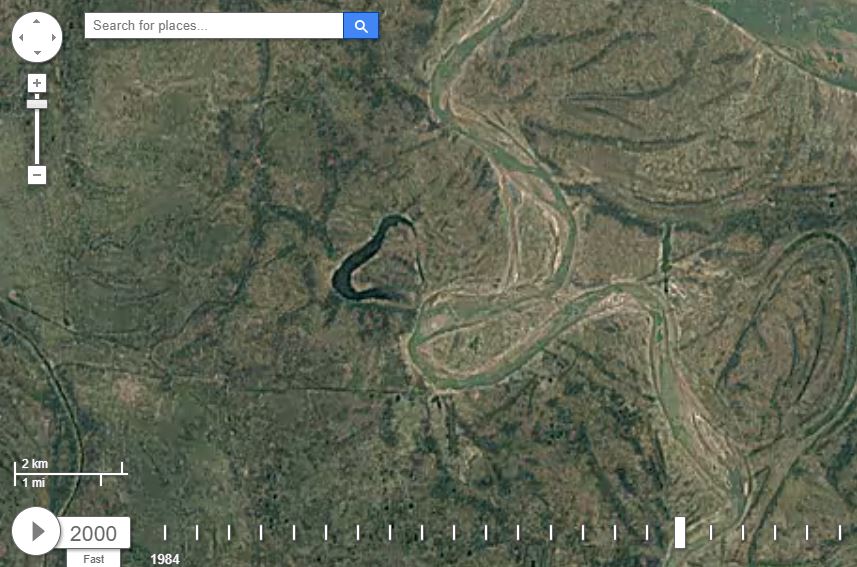
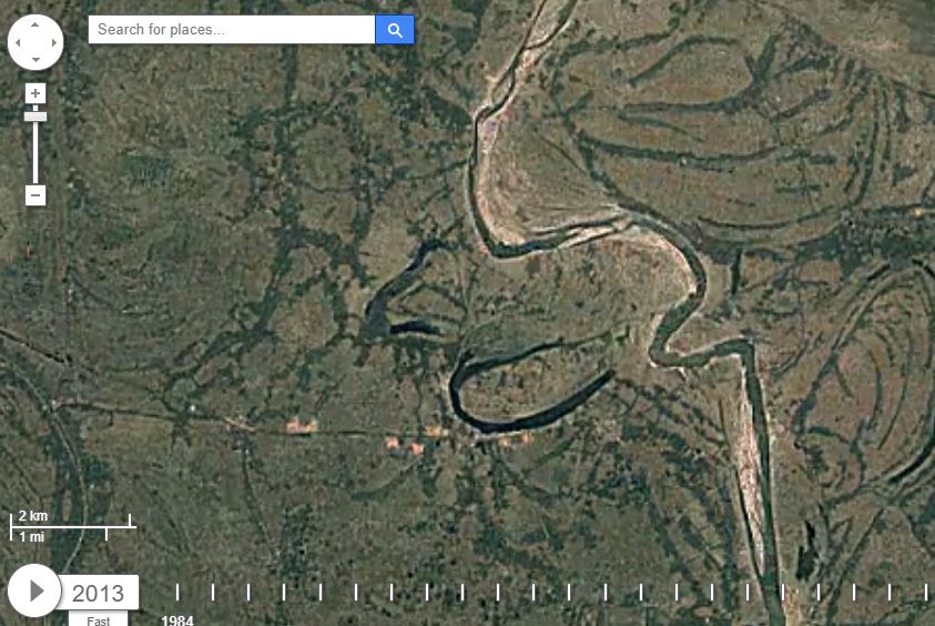
Monitoring geomorphological changes over time through satellitesThrough the use of optical data from satellites and aerial LiDAR measurements, we are examining the topographic and geomorphological changes over time. These geological processes actively shape our planet today, and have been doing so through known geological time. By analyzing data gathered in the past few decades, we can understand the relatively fast moving geological processes such as the alternation of meandering rivers and fast melting glacial processes. These processes are analogous to previous geological events, therefore by understanding the present, we can reconstruct the paleoenvironments of the past.
|
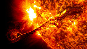
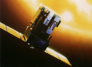
Solar influence on our planetUsing observations from mainly the Geostationary Operational Environmental Satellite system (GOES), the Solar and Heliospheric Observatory (SOHO) and the Kepler mission we are studying the variability of the Sun. Partly by observing the Sun and partly by observing other Sun-like stars. We are then using our knowledge about the variability of the Sun in general circulation climate models in order to understand how this variability has and will affect our planet.
|
|

|
|
Christoffer Karoff
[email protected] |
Phone |
+45 2118 3926
|
Address |
Høegh-Guldbergs Gade 2
8000 Aarhus C |
Website created by P. Kongstad
